Tour overview
Langtang is a narrow valley that lies just south of the Tibetan border. It is sandwiched between the main Himalayan range to the north and slightly lower range of snowy peaks to the south. Langtang Lirung (7246m.) dominates the valley to the north, Gang Chhenpo (6388m.) and Naya Kangri (5846m.) lie to the south and Dorje Lakpa (6966m.) protects the east end of the valley. The area was designated Nepal’s first Himalayan national park in 1971. This high and isolated region is inhabited by Tamang’s whose religious practices, languages and dress are much more similar to Tibetan. A visit to the Langtang valley offers an opportunity to explore villages, to climb small peaks and to visit glaciers to comfortably low elevation. According to legend, a lama following a runway yak discovered the valley. Hence the name – Lang is Tibetan for “yak” and tang means “to follow”.
This Langtang Trek towards the base of Langtang Himal, north of Kathmandu valley offers the shortest approach to snowy mountains from Kathmandu. The Langtang Trek starts from Syabru Besi, following a trail upstream Langtang Khola through ethnic Tamang villages, lush green forests and the wide Kyanjin valley surrounded by snowy peaks from all four sides and get opportunity to ascend Kyanjin Ri (4773m), from where we get 360 degree mountain panoramic views. We retrace our route back down the valley to Syabru Besi and drive back to Kathmandu.
Trip Facts:
Duration: 13 days
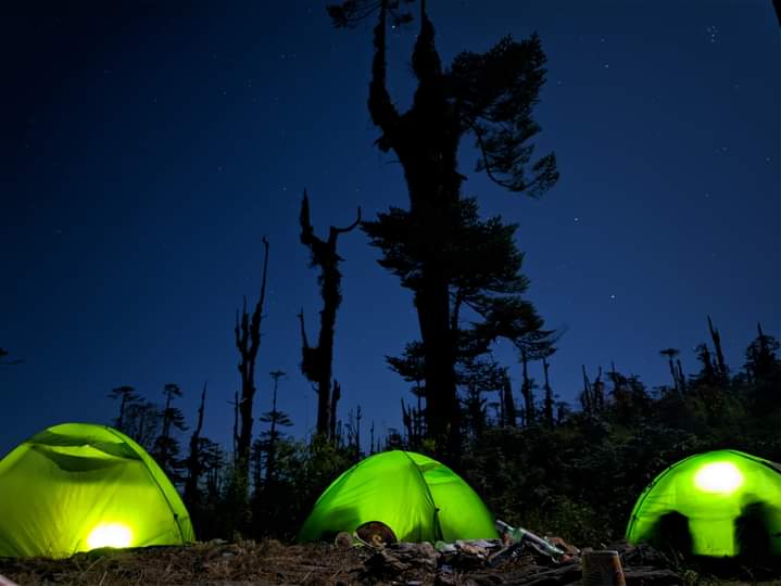
Type of the Trek: Tea House, Camping
Activities: Trekking, Culture Tours
Best Months: September to November and March to May
Maximum elevation: 4773m (Kyanjin Ri)
Grade: Moderate
Trip Highlights:
*Close to Kathmandu, Trek through forests to alpine valley just south of the Tibetan border, Good panoramic mountains and alpine views.
*Tamang cultural heritage, Tibetan style villages, old monasteries.
Day 1: Arrive in Kathmandu (1350m)
Our representative will meet you outside the customs and immigration area at the airport. He or She will brief you on the immediate arrangements and escort you to your hotel. The trip leader will hold a short briefing in the hotel regarding trek arrangements and general orientation to Kathmandu.
Day 2: Sightseeing in Kathmandu Valley
Today, we visit the most historical and Spiritual attractions in Kathmandu which are also listed in world heritage sites. We visit Durbar Square, Swayambhunath (Monkey temple), Bouddhanath, which is one of the largest Stupa in the world and the sacred Hindu temple of Pashupatinath.
Day 3: Drive to Syabrubesi (132 km / 1460m / 5-6 hrs)
It is about 5-6 hours drive from Kathmandu on a rough, deteriorating paved highway that twists and climbs over ridges to the Trishuli valley. Passing Balaju and Nagarjun, the road leaves the Kathmandu valley at Kakani (2145m), where there are excellent views of Annapurna II, Manaslu and Ganesh Himal and descends into the broad Trishuli valley. We drive through the Ranipauwa, this is the large village and is the radish capital of Nepal. After a long descent through terraced fields, the road crosses the Tadi Khola then climbs onto a plateau and passes fields of mustard, corn and rice. The road then passes an army camp and rolls into Trishuli Bazaar at 548m. There are many shops and hotels. The Dhunche road starts at a petrol station in Trishuli Bazaar just before the bridge and follows the east bank of the Trishuli River. The road passes two bridges carrying massive pipes that feed the hydroelectric project and climbs slightly to Betrawati at 620m. Betrawati is the junction of the Trishuli and the Phalungu Khola. At Betrawati the road crosses the Phalangu Khola then switchbacks at the end of the ridge for 15 km, through Brahman and Chhetri villages to Kalikhastan at 1390m. There is the entrance to Langtang National Park; the police check the permit here. The road reaches its high point on the ridge at 1980m then makes a long contour with a few ups and downs through oak and rhododendron forests, passing above Ramche and Thare and then reaches Dhunche, the administrative headquarters of Rasuwa district, at 1950m. Just before Dhunche is the national park headquarters. Little further, there is army check post where we should show our national park permit. Dhunche is a picturesque village with narrow streets lined with buildings. The main part of Dhunche is below the road. In Dhunche here are many nice hotels, restaurants, shops and camping ground. This is the trekking starting point for Gosainkund trek. From Dhunche we drive 15 km further to Syabrubesi. We drive through Thulo Bharkhu and then descend down to Bhote Koshi. Syabrubesi is an interesting village on the banks of the Bhote Koshi at 1420m. Here are several good hotels with attached bathroom, restaurants and shops.
Day 4: Trek to Lama Hotel (2380m / 6-7 hrs)
Leaving Syabrubesi we check at police check post and cross Bhote Koshi River, walk through old Syabru village and cross Langtang Khola by long suspension bridge. After bridge we gently ascend to the trail junction, follow the lower trail, several small ups and downs and through beautiful forests, we arrive in beautiful waterfall. About 30 minutes later from waterfall we arrive in Domen, here is a very good suspension bridge and 2 simple hotels. From here it is steep climb for 10-15 minutes. Few min later, the trail from Thulo Syabru village join with this main trail and then descend and ascend to Pairo (Landslide), here are just 2 hotels. Along the way the sceneries are wonderful. The trail ascend continues to Bamboo, it is nice walk through the forest. There are some hotels and camping grounds. After Bamboo the path is long climb and then little descends down to the long suspension bridge, cross the Langtang Kola. There is a small simple hut in the other side of the bridge. Climb steeply to a landslide and the Langtang view, the first hotel at Rimche. The upper Rimche is about 25 minutes further from here (top / 2250m). There is a trail junction that connects to a high route back to Syarpa gaon and Syabrubesi. We descend gently to Changtang, and popularly known as Lama Hotel at 2380m. Here are several lodges including Lama Hotel itself, and a few camping spots. It is surrounded by forest. All the hotels are clean but not attached bath rooms. Today, we can see many birds and wild animals on the way (Yellow throated martin, wild boar, langur monkey, Red panda and Himalayan black bear.
Day 5: Trek to Langtang village (3500m / 5-6 hrs)
Leaving the Lama hotel, we gradually ascend through nice forest along the river side. About 1 hr 15-20 minutes later from Lama Hotel, we arrive in Gumanchok. We cross small stream before Gumanchok. There are some small climbs and mostly gentle ascend. The Langtang Lirung (7246m) appears through the trees. At Gumanchok is the Riverside lodge, on the banks of the river and some others. 15 minutes later there is another hotel. After Gumanchok the path is very easy for 25-30 minutes then steep climb through beautiful forest to the small top, there is old cairn and prayer flag. From here it is flat route for a while and then gradually ascends to Ghora Tabela at 3000m. Once a Tibetan resettlement project, this is now a Nepal army and national park post and has no permanent inhabitants. Here are 2 lodges and restaurants. The trail ascends gradually, as the valley becomes wider and wider, past yak pastures, and some Mani stones. About 45 minutes later we climb steep up and arrive in Thangshyap village, here are several hotels. It offers wonderful views of snowy peaks and Langtang valley. We walk through Chyamki village, cross a stream by long suspension bridge and gradually ascend to Gomba village, there are some hotels and shops in Gomba village, Gomba is at the top of the village. We can see wonderful views of Gangchhenpo and some other peaks and the valley. From here we descend gently to long suspension bridge. Langtang Lirung, other snowy peaks and small glaciers are on the top above the monastery. Past a Army check post, several water driven mills and prayer wheels then gradually ascend to the large settlement of Langtang village at 3500m This village is the headquarters for Langtang National park. Here are many good hotels. The houses of Langtang and the neighboring communities have Tibetan style flat roofs and are surrounded by stone walls enclosing fields of buckwheat, potatoes, wheat and barley. The villagers keep herds of yaks and cattle here and in pastures above the village. It is nice views of Langtang Lirung, surrounding snowy peaks and Gangchhenpo is on the top of the valley.
Day 6: Trek to Kyanjin Gompa (3800m / 3 hrs)
The trail winds through the village and climbs onto a ridge dominated by a large, square Chhorten and a long Mani walls. After this, the path bit descend and then ascend to the Mundu village, here are many Mani walls and some simple hotels. From here, the path ascends gradually through beautiful Yak pasture grounds to Yamphu, here are few small tea shops. Yamphu is the bottom of Kyanjin Gomba. From Yamphu we climb a moraine and finally arrive in Kyanjin Gompa, situated at the bottom of Kyanjin Ri, here are many good hotels. Some new hotels have attached bathrooms but mostly they don't use it because of frozen. They also provide hot shower. All the hotels are normal but very clean and beautiful buildings. The Swiss Association for Technical Assistance started the Cheese factory in 1955. It is easy to reach Kyanjin Gompa before lunch. In the afternoon we can visit around. It is surrounded by many snow capped peaks.
Day 7: Hike to Kyanjin Ri (4773m / 5 hrs / up and down)
There are two good viewpoints in the area that we can climb. The peak to the north of Kyanjin Gompa is Kyanjin Ri, about 2 hrs 50-60 minutes climb. There are 2 different paths to go in Kyanjin Ri. The best idea is to go up through ridge line. Leaving the hotel, the path goes towards Gomba and then turns right side below the new Stupa. It climbs up by making zigzag. The path is very clear and views are becoming wonderful. About 1 hr later, we arrive in bottom of the black hill and then climb up to the top of the ridge line. From here, we walk along the ridge line, gently ascend and then steeply climb up to the top. It is very nice views of Langtang Lirung, many snowy peaks around and several huge glaciers and Moraine. Kyanjin Ri is the best point to see mountain views, here are many prayer flags. It offers really wonderful views of Langtang Lirung, Kimsung and many other peaks in the front, in the back side can see Langshisha Ri, Gangchhenpo, Naya kanga, some other peaks and several huge glaciers. We reach very close to the peaks and glaciers. From Kyanjin Ri, we descend down to the small valley (on the way back). We continue to descend down along this deep small valley. It is not any good views but we can see just some snowy peaks and some parts of the valley in the front. About 1 hr 40-50 minutes later from the top, we turn to the right side (from where the path Separate for Tsergo Ri) and descend down through steep hill slope to the hotel.
Day 8: Hike to Langshisha Kharka (4080m) and come back / 7-8 hrs / up-down
Today we continue further up the Langtang valley to Langshisha Kharka for views of Langshisha Ri (6560m), Gang Chhenpo (6378m), Dorje Lakpa (6966m), Urkeinmang (6143m) and Pemthang Karpo Ri (6865m). There are no facilities beyond Kyanjin Gompa, but we make just day trip and return to Kyanjin Gompa.
Day 9: Trek to Langtang
Re-trace.
Day 10: Trek to Lama Hotel
Day 11: Trek to Syabrubesi
Day 12: Drive to Kathmandu
We have wonderful and scenic drive back to Kathmandu. After Trishuli Bazar, we take different road to Kathmandu. This is much better than old road but not Mountain View. We follow the Trishuli River all the time and drive through beautiful small market areas, villages and join with Pokhara Kathmandu highway then follow this highway to Kathmandu. We have lunch on the way in nice restaurant. In the late afternoon we visit around Thamel for shopping and have farewell dinner in typical Nepali restaurant with cultural program.
Day 13: Departure from Nepal
We will escort you to airport for your international flight.